The “Dams” and Government Sidings.
Story by: Brian Ballard, Friends of the Aldershot Military Museum
During the 1940s, we, that is our little gang from North Town, often played “up the arches”, an area bounded by the bridge at the end of North Lane which carried the main-line railway, the bridge over which the Government Siding was carried to the Field Stores and the unmade stretch of track which went under the arch and curved left along Thornhill Hollow and met Ordnance Road at the level crossing outside the entrance to the Field Stores.
North Lane ceased to be a concrete road at the junction with Deadbrook Lane and from there was a wide, very rough track churned up by years of use by tanks and other military vehicles. The ruts could be as high as our knees and the pot-holes so large that we could stand in one, as high as our chests, and not be able to reach the rim with outstretched arms! These pot-holes would be filled with water after heavy rain washed down from Peaked Hill and our “gumboots” were of no use then!
On our left was a grazing meadow in which furze and broom grew thickly as it neared the railway embankment and on our right was a tilled field. Water-filled ditches bordered the track on both sides.
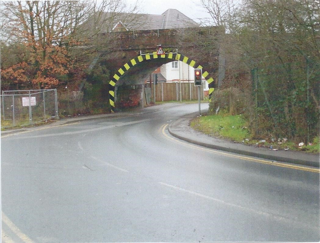
Above: The railway arch, from the north side. The site of the “Dams” was behind the camera.
Emerging the other side of the bridge we would see, directly ahead, a patch of rough grass and furze and broom, blackberry bushes and stunted trees growing irregularly to the left and right. Through a gap in the bushes we could see the embankment of the Government Sidings rails and above that the fence and buildings of the R.E.M.E. Workshops. Passing through the gap the ground dropped away sharply to what appeared to be a stream trickling along.
This was, in fact marked on a map dated 1868, as a “Foul Drain” which took excess surface water and other waste away from the camp to drain into Deadbrook Pond. This drain water emerged from a culvert under the level crossing and entered another near the main-line railway to emerge again in the field the other side of the embankment and flow along a ditch to the pond.
The drain between the culverts, perhaps 300 yards in length, had been constructed of brick and was circular in section up to above its half-way level. A short distance from the upper culvert the drain opened up and the water ran over a square of concrete which we called the “Slippery Docks” as it was covered in slimy green weed. This concrete slab must have been the base of a filtering works which once stood there and which is marked as such on the 1868 map. The drain closed in again but was completely overgrown by the furze, broom and bramble on either side until it opened out again as previously described.
This open area was known to generations of children as “The Dams”, and must have come about, over the years before the workshops were built, by soldiers using it as a short cut from the pubs in North Town, across the embankment and back to camp and similarly civilians going to and from their jobs in the camp. Once a path had been worn through the scrub, lining bricks removed and the gulley sides had been flattened by the pounding of many boots it became accessible to children who carved into the hard sand banks (as I have) and trampled the sand into small “beaches”.
“The Dams” then became one of the most favourite haunts of three generations of kiddies, lending itself to many different activities, even paddling in the foul water! The favourite past-time, and the one which gave the area its name, was of course building dams and sailing make-shift boats in the resulting “lake”. In my time, obviously inspired by the war, we would breach the dam by bombing, throwing stones at one spot until it gave way.
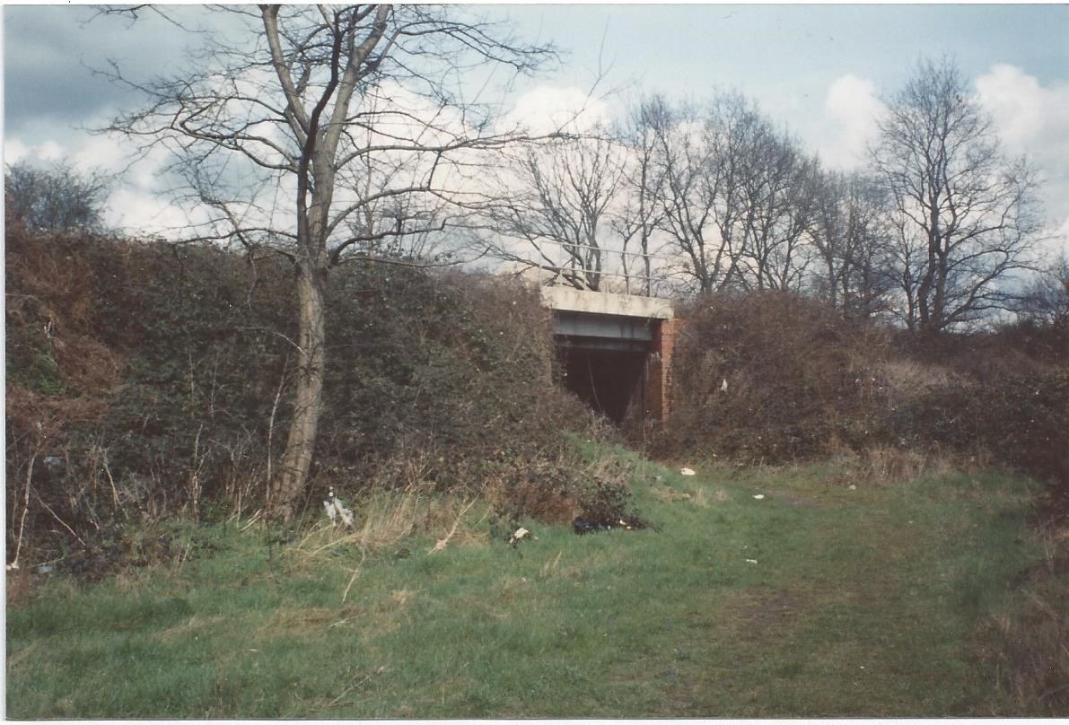
Above: The bridge carrying Government Sidings, a short distance to the right the rails joined the main-line. The culvert took the drain water underground here to the other side of the railway lines.
Another favourite past-time was building camps in the gorse and broom which grew thickly on both banks of the ditch, as we called it. If another gang found it, it would be destroyed and the materials used to build their camp. This was an activity also described by Percy Burgess, of Alexandra Street, in his memoirs of the period 1890s to WW1. He and his pals spent a great deal of time building and knocking down “forts” and fighting other gangs over them.
One day a few of us older ones (8 or 9 years old!) decided to try something different, so, we walked, rather we crab-walked along the gulley, with a foot pressing on the lining bricks either side and above the water and made our way from “The Dams” to the culvert where the water flowed under the main railway line at the sidings bridge, no easy task as it was completely overgrown with gorse that constantly pricked the flesh and brambles that snagged clothes. Arrived at the culvert, which was tubular and stood about shoulder height, we entered and progressed a short distance before it became too dark to see. We returned to daylight and, after a short debate, decided to return after lunch with torches and gumboots! This we did and we walked, slightly stooped, the whole length except for the last few yards where the “tunnel” became larger, possibly because a couple of sections were larger in diameter. This caused a sudden drop of about a foot and a deep puddle formed and, caught by surprise, most of us had our gumboots filled with that nasty smelling water! We now stood upright and advanced the last short stretch to the daylight – the light at the end of the tunnel! When we emerged we found ourselves standing in a ditch which ran the length of the tilled field at the base of the railway embankment and down to Deadbrook Pond, now just a bog. Thereafter we became rivals, each competing to record the greatest number of return trips made! Strange perhaps, but we often competed to climb higher up a tree or jump the brook or similar tasks, we once competed to be the first to jump from each of the three diving boards at the bathing pool, before any of us could swim!
“The Dams” became the focus of attention for an entirely different reason in 1945, the war in Europe was over and troops were coming home. For many of them this meant entraining to Aldershot and occupying barracks until they were demobbed or posted. They disembarked in the Field Stores but were first held in waiting to go through Customs and the carriages were parked on the stretch of Government Sidings between Ordnance Road and the main line. We kiddies climbed the embankment at “The Dams” and walked up and down the carriages, gratefully accepting anything that the soldiers threw to us – anything from chewing gum to Iron Crosses! I never had one of those but I did collect a lot of pre-war coins and bank notes, and also Allied occupation coins and bank notes from France, Belgium, Holland, Italy and Germany, which I have kept safely in albums for the last 70 years.

Above: Allied Occupation and domestic coins, banknotes and German occupation coins. A few examples from my collection obtained from returning soldiers.
In 1946, a concrete road was constructed over the rough track between the arch and Ordnance Road, by German prisoners-of-war, but “The Dams” site was not affected for a few more years.
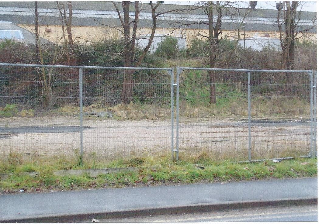
Above: The site of “The Dams”.
It was levelled and occupied by the offices of a vehicle driving test centre for years. The tree on the grassy area stands where the “foul water drain” opened out and provided a ford crossing over the common where the R.E.M.E. Workshops were later built and also a favourite playground for generations of kiddies. The grass and foliage covered embankment still carries rails of the disused sidings. The car park, above, of the test centre is now built upon and the site is completely obscured by housing. The rough track on the North Town side of the mainline railway arch was made up by the civilian authorities at a much later date.
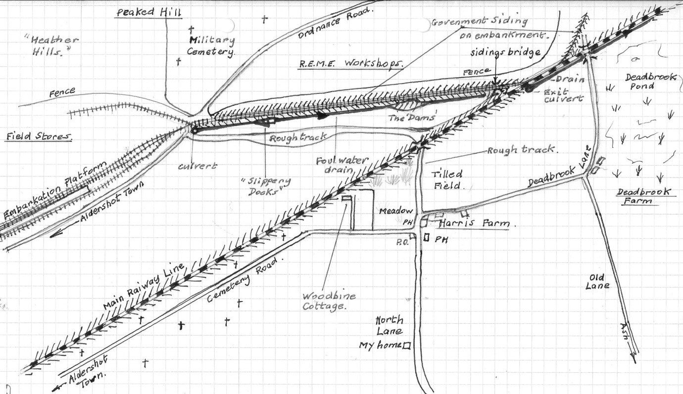
Above: A sketch map of “The Dams”, Government Siding and the “foul drain” (Not to scale).
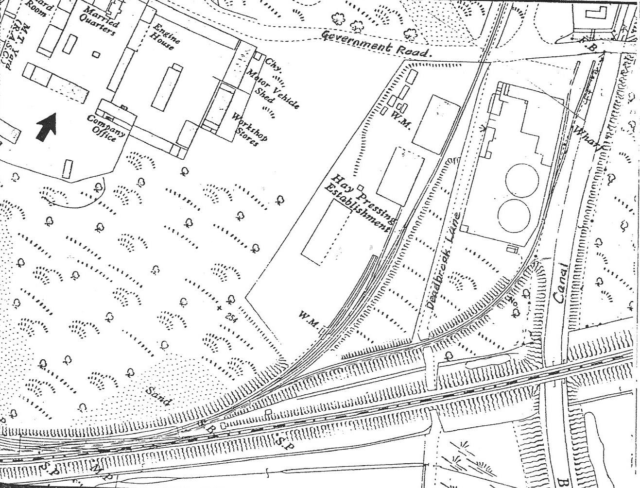
Above: A plan of the sidings which extends to the canal wharf area and military power station.
Copyright © 2015 Brian Ballard.